Drone Surveying
Drone-ing the Extra Mile!
Overview
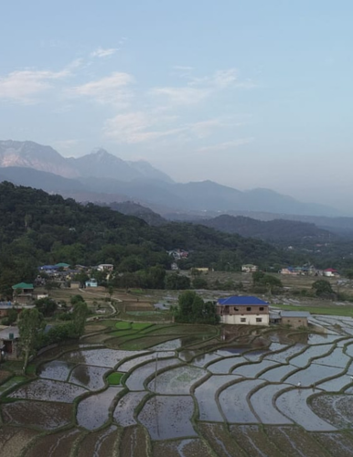
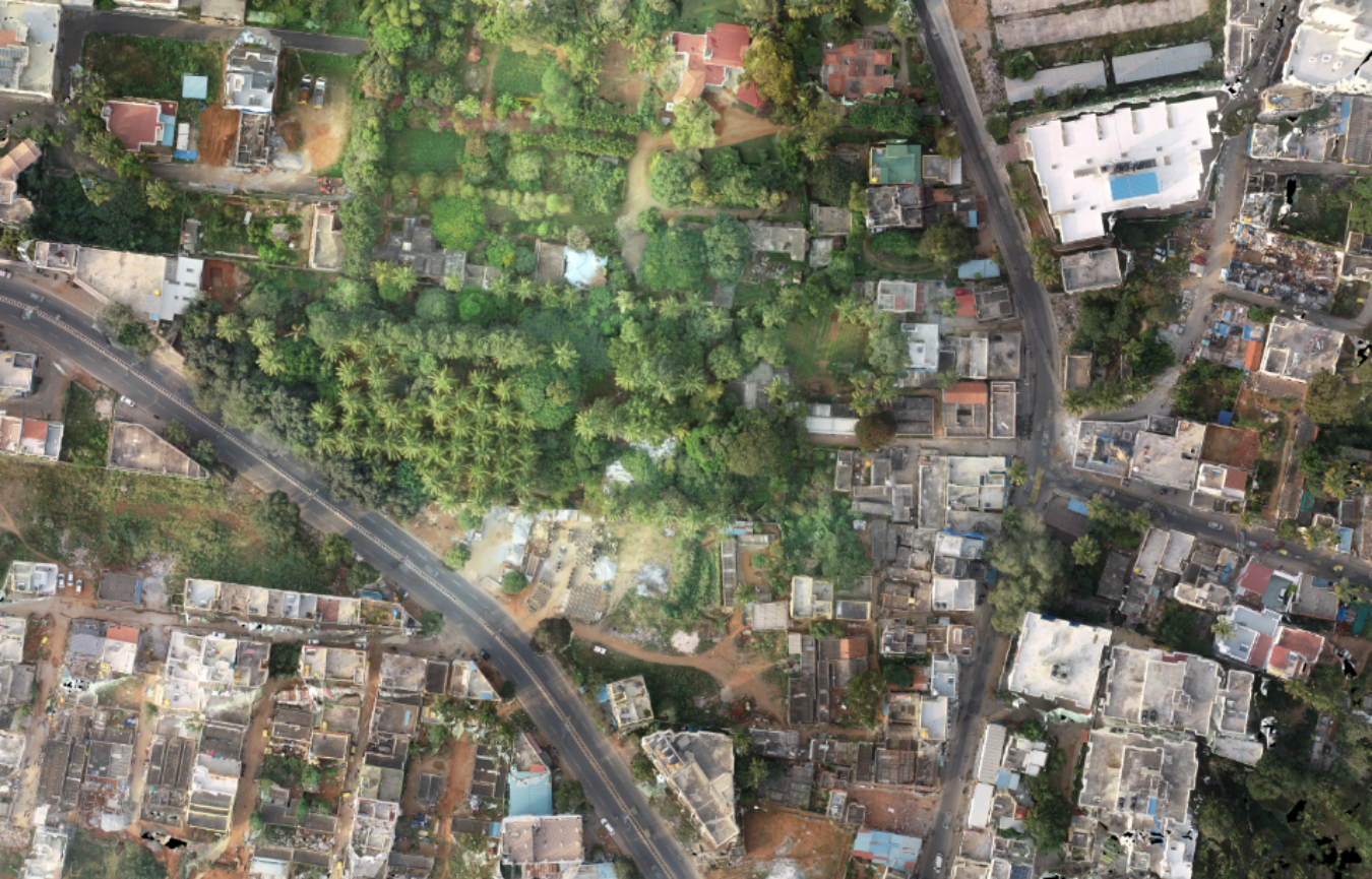
Our Drone Surveying service offers cutting-edge capabilities to capture high-resolution aerial imagery and topographic data using advanced UAVs (Unmanned Aerial Vehicles) and state-of-the-art sensors. This technology empowers us to survey large areas and reach inaccessible terrain with unprecedented precision and efficiency. Drone surveying finds extensive application in diverse industries, from land mapping and construction site monitoring to infrastructure inspection and environmental assessment. With our aerial surveying expertise, we provide valuable insights and data that enable informed decision-making and optimize various projects.
Edge 3D's Expertise:
At Edge 3D, we boast a team of skilled and licensed drone operators who are well-versed in the art of aerial surveying. With years of experience and a comprehensive understanding of drone technology, our experts efficiently plan and execute survey missions to meet your specific project requirements. From capturing detailed images to generating accurate topographic data, our team ensures that you receive reliable and actionable information for your projects.
Equipment
To deliver top-notch drone surveying services, we employ advanced UAVs equipped with high-resolution cameras and cutting-edge sensors. Our fleet of drones is capable of covering large areas efficiently and capturing data with remarkable precision. We invest in the latest drone technology and ensure regular maintenance to guarantee the highest quality and safety standards in our aerial surveys.
Application
Our Drone Surveying service offers versatile applications across various industries. For land mapping and planning, we provide detailed topographic data that aids in urban planning, agriculture, and environmental management. In the construction industry, our aerial surveys enable efficient site monitoring, progress tracking, and identification of potential issues. Infrastructure inspection and maintenance benefit from our drone surveys, as we can access and assess hard-to-reach structures with ease and accuracy.
Output Formats
Edge 3D provides drone surveying outputs in a variety of formats, including high-resolution imagery, ortho mosaic maps, point clouds, and digital surface models (DSMs). These formats can be easily integrated with GIS (Geographical Information Systems) and CAD (Computer-Aided Design) software, allowing seamless incorporation of the survey data into your existing workflows.
Case study
With Edge 3D's Drone Surveying service, you gain access to advanced aerial survey technology, comprehensive data insights, and a reliable partner in driving the success of your projects.
Case studies coming soon ...
Use Cases
Aerial Surveying and
Mapping:
Pipeline Inspection and Monitoring:
Facility Inspection and Asset Management:
Comprehensive Renewable Energy Infrastructure Inspection: